Walks around Presteigne and Norton
Section one comprises ten local walks of varying lengths produced for the Town Council.
Section two comprises five walks produced by Presteigne Area Community Development Group/Chatterbrook WI.
All walks follow public rights of way/highways and are undertaken at walkers' own risk. The Town Council cannot be held responsible if routes are temporarily blocked or impassable for whatever reason but it will report any issues to the County Council if notified to presteigneandnortontc@outlook.com.
Section One -
Ten varied walks ranging from an easy access route taking 25 min to a strenuous 17.5 km hike.
Starting from either The Assembly Rooms in Presteigne or St. Andrew’s Church lych gate in Norton.
With thanks from the Town Council to Radnor Ramblers for researching, checking and writing up each of these routes.
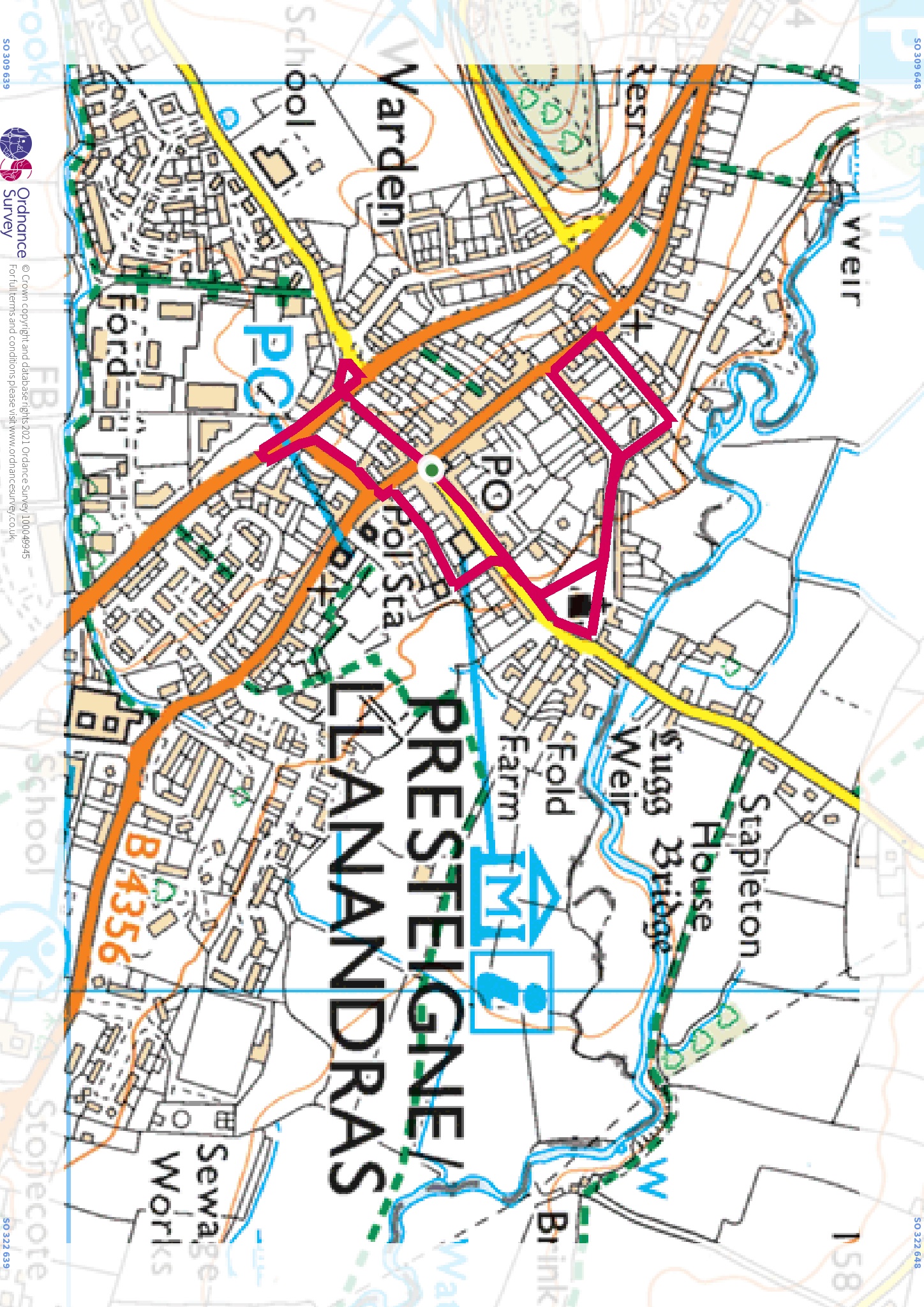
Walk 1 Easy Access 1.8 km 25 min Assembly Rooms, Presteigne flat This walk is a gentle, flat stroll around Presteigne town, designed to be accessible for everyone, including the use of wheelchairs, mobility scooters and buggies. Although only short, it takes you around some of the fronts and backs of the delightful range of architecture in Presteigne, giving glimpses into the town’s rich history. See how many blue plaques you can spot on your route.
Walk 1 Leaflet here 62kb pdf. GPX Route Map here 2kb zip file. Map here 1.3mb jpeg.
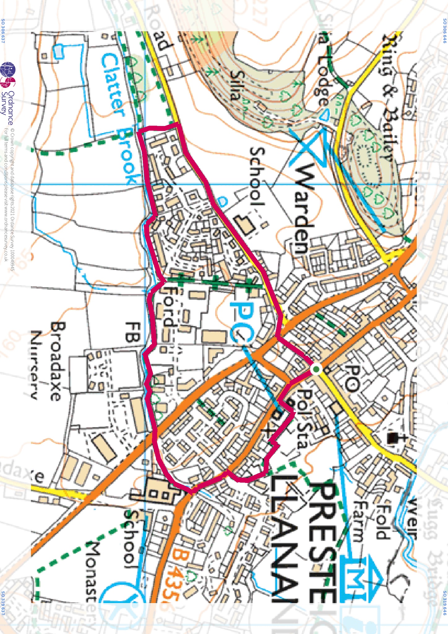
Walk 2 Easy 2.2 km 45 min Assembly Rooms, Presteigne flat This walk follows the path of Clatter Brook though an oasis of peace despite running through an industrial estate. The brook can vary between completely dry in summer and flooded at times of high rainfall. Wellies or strong walking boots are advised as the terrain is rough and can be very wet. A great short walk to keep youngsters amused.
Walk 2 Leaflet here 209kb pdf. GPX Route Map here 2kb zip file. Map here 1.3mb jpeg.
Walk 3 Leisurely 5.8 km 1 ¼ h Assembly Rooms, Presteigne mainly flat A delightful flat and easy route East from Presteigne across meadows and fields alongside the Lugg, circling round to Wegnall Mill on quiet tracks and back to Presteigne via a wooded footpath and peaceful lane.
Walk 3 Leaflet here 140kb pdf. GPX Route Map here 3kb zip file. Map here 1.1mb jpeg.
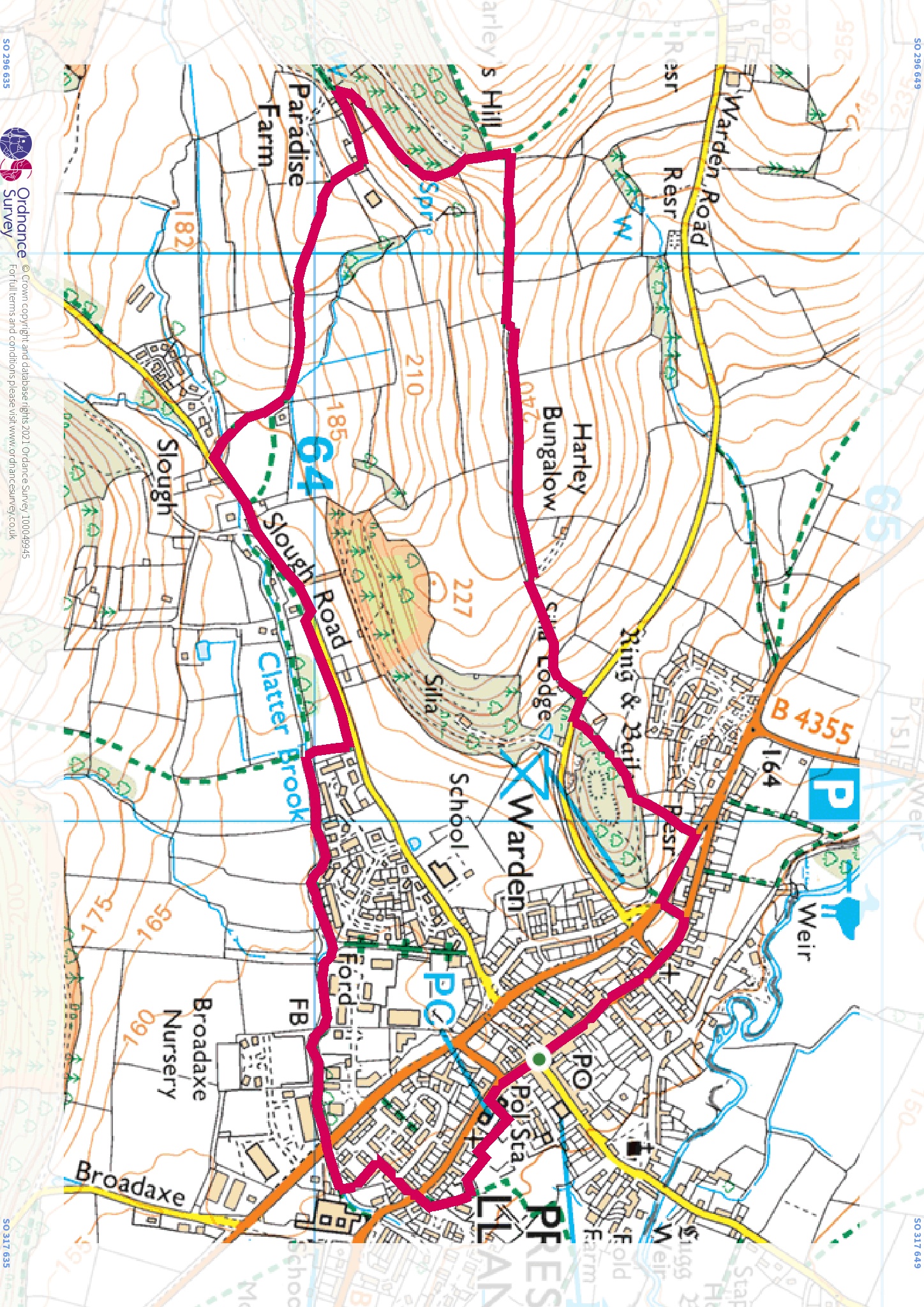
Walk 4 Moderate 5.2 km 1 ½ h Assembly Rooms, Presteigne 170 m total climb Although this walk is short, there are a couple of steep climbs. You are rewarded, however, with panoramic views of the whole area. Leaving town via the historic Warden Site with its Ring and Bailey, the route climbs to the edge of Harley’s Hill before dropping down through Paradise Farm to return via Clatter Brook. In winter, if the latter is impassable after heavy rains, an easier alternative is given. Walking boots recommended.
Walk 4 Leaflet here 189kb pdf. GPX Route Map here 4kb zip file. Map here 2.4mb jpeg.
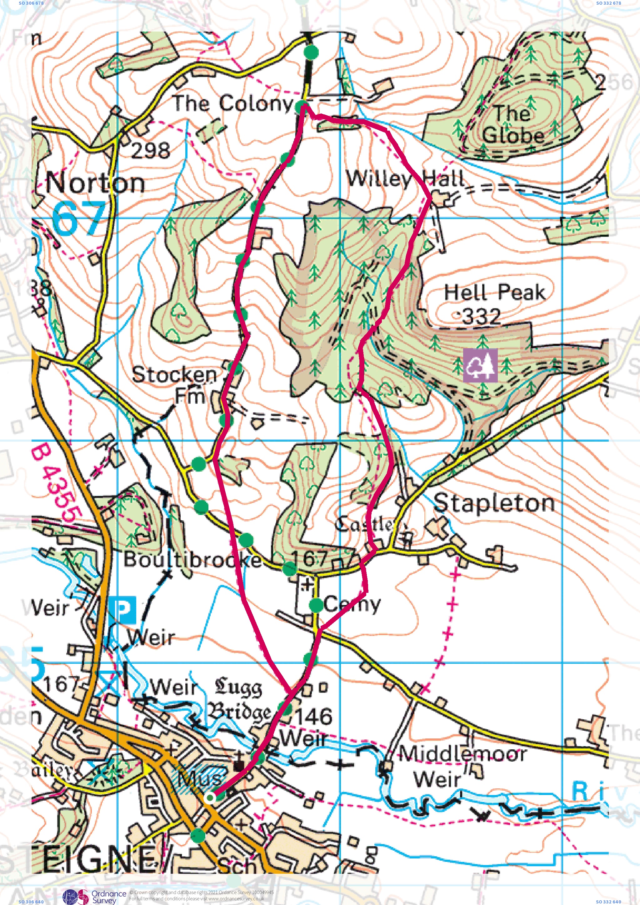
Walk 5 Moderate 7.4 km 2 h Assembly Rooms, Presteigne 255 m total climb Crossing the Lugg and heading north the route uses tracks and footpaths up past Stapleton Castle, through Stapleton Wood to The Colony. The return downhill gives glorious views as far as the Brecon Beacons, leading past Stocken Farm and across fields back to Presteigne. Walking boots recommended.
Walk 5 Leaflet here 62kb pdf. GPX Route Map here 4kb zip file. Map here 2.4mb jpeg.
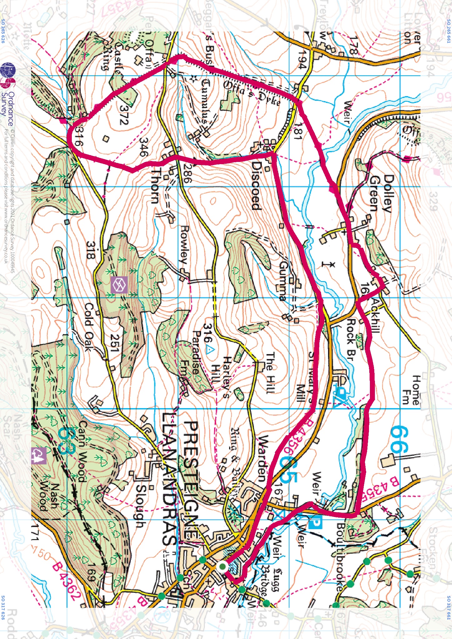
Walk 6 Strenuous 14.5 km 3 ½ h Assembly Rooms, Presteigne 500 m total climb This route heads east through Ackhill to join the Offa’s Dyke path at Dolley Green and crossing the Lugg before climbing up towards Penn Offa and Hilltop Plantation, offered glorious views in all directions. It then skirts round Evenjob Hill returning via Thorn and Discoed, retuning via quiet lanes and footpaths to Presteigne. Be prepared for a strenuous climb; walking boots, suitable clothing and light refreshments are strongly recommended. Note: Brief sections of this route are along B roads. You can walk on the grass verge but care should be taken.
Walk 6 Leaflet here 64kb pdf. GPX Route Map here 5kb zip file. Map here 1.6mb jpeg.
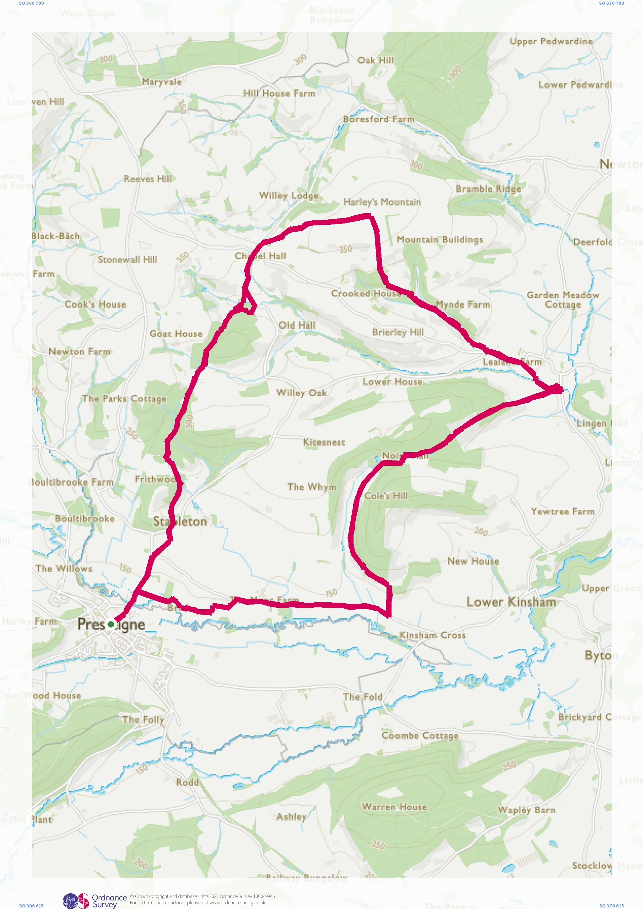
Walk 7 Strenuous 17.4 km 4 ½ h Assembly Rooms, Presteigne 620m total climb Starting from the Assembly rooms in Presteigne, this walk heads North through Abley’s Wood, Stapleton Wood and the Globe to join the Herefordshire Trail over Harley’s Mountain to Lingen. From Lingen the route continues on the trail through Lingen Valley Wood, around Cole Hill and along a quiet lane past Brian’s Ground, returning to Presteigne on footpaths near the Lugg. Walking boots, suitable clothing and light refreshments are strongly recommended.
Walk 7 Leaflet here 72kb pdf. GPX Route Map here 7kb zip file. Map here 1.5mb jpeg.
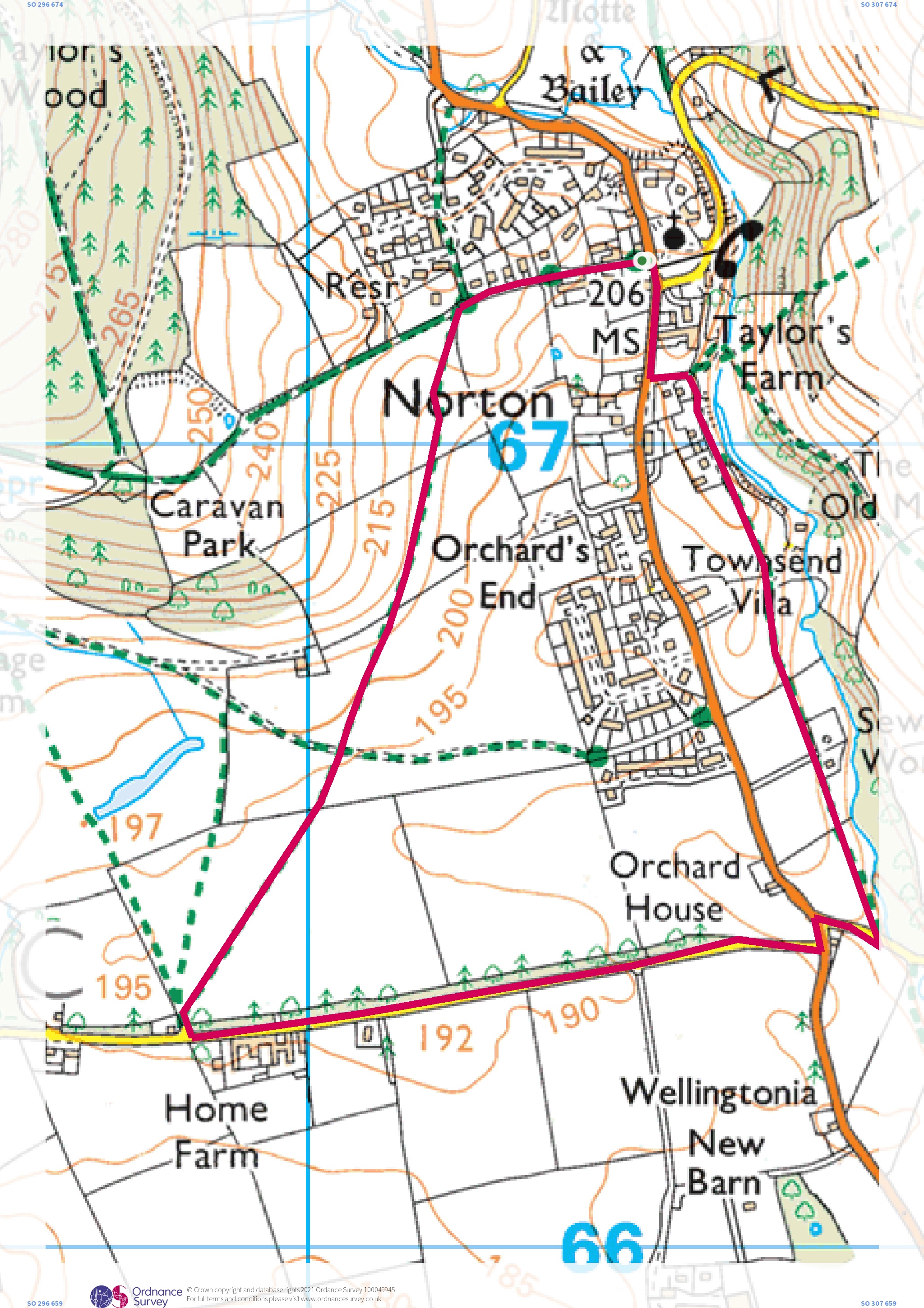
Walk 8 Easy 3.1 km 45 min Norton Church mainly flat A short circular walk with stunning views around Norton, on field paths and quiet lanes.
Walk 8 Leaflet here 234kb pdf. GPX Route Map here 2kb zip file. Map here 1.8mb jpeg.
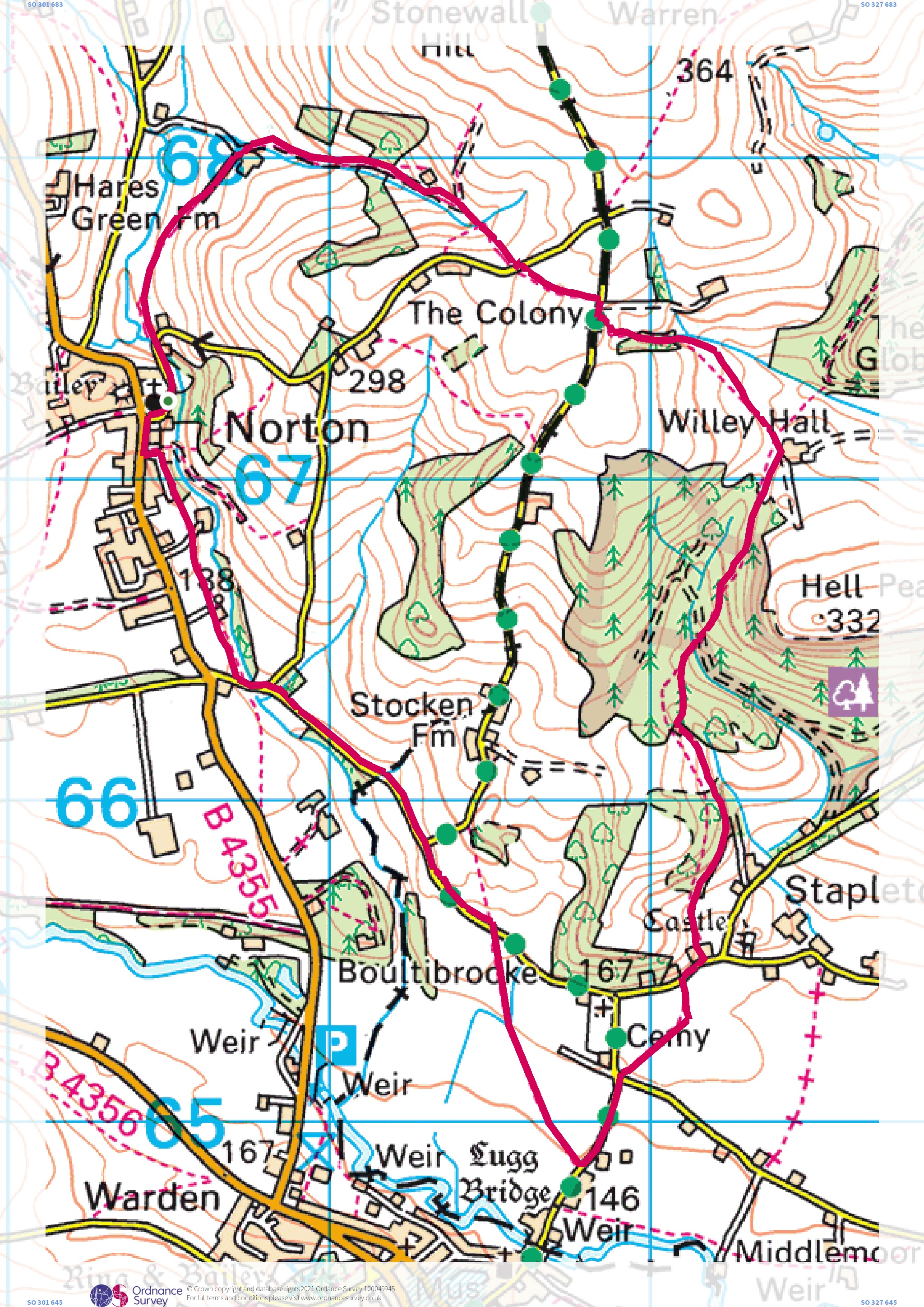
Walk 9 Moderate 8.6 km 2 ½ h Norton Church 350 m total climb A longer walk from Norton in open countryside and woodland. The route climbs towards Stonewall Hill then descends via Stapleton Wood past the ruins of Stapleton Castle to the edge of Presteigne before returning to Norton via field paths and quiet lanes. Can be muddy at times; walking boots, suitable clothing and light refreshments are strongly recommended. Note: this walk can also be started in Presteigne at the footpath just north of the bridge over the Lugg in Bridge Street, see point 6 of the instructions.
Walk 9 Leaflet here 310kb pdf. GPX Route Map here 6kb zip file. Map here 2.4mb jpeg.
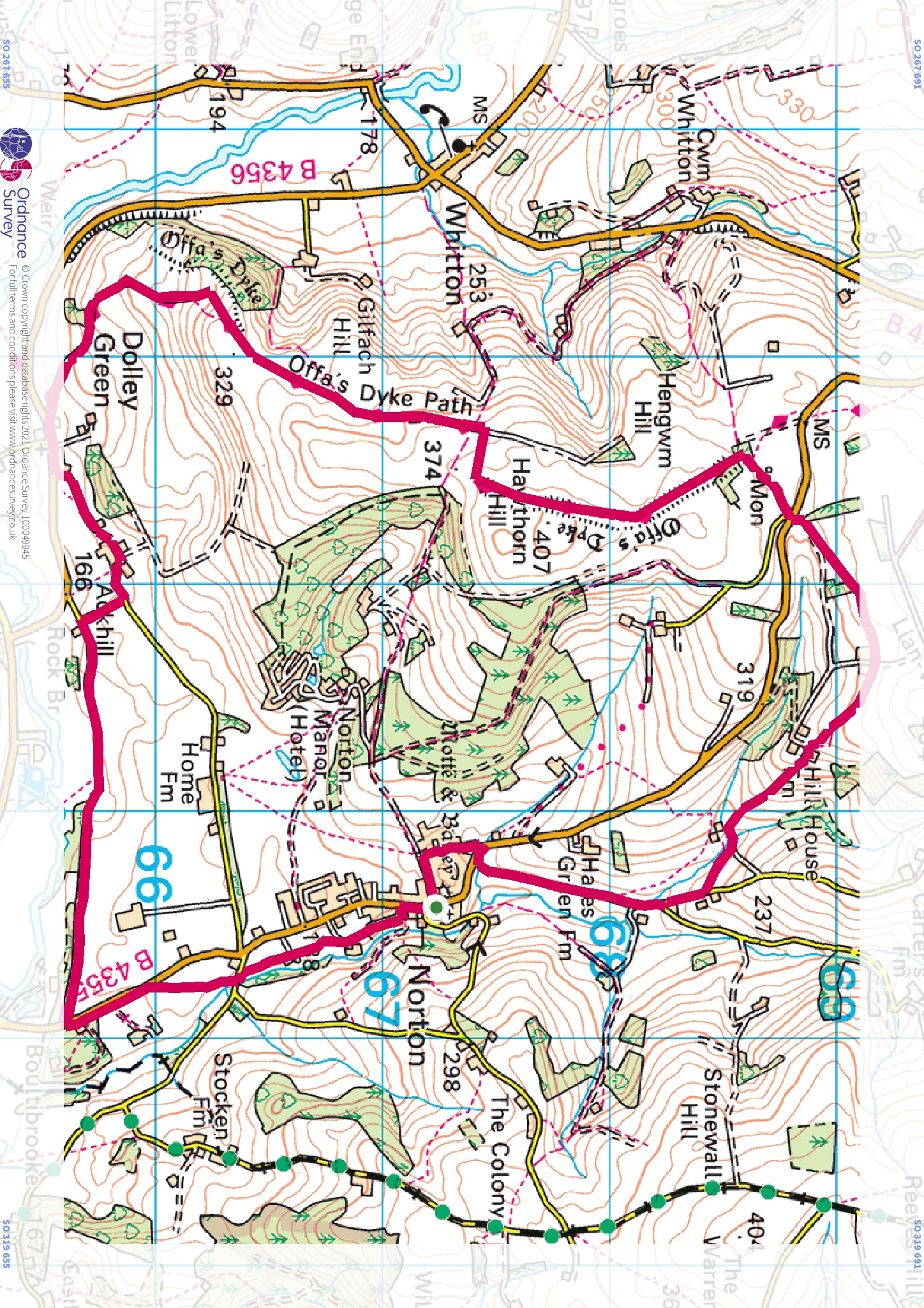
Walk 10 Moderate 13 km 3 h Norton Church 340 m total climb Starting from Norton Church, the route climbs to join the Offa’s Dyke path North West of Norton, with stunning views in all directions, then descends to Dolley Green and follows a green lane and footpaths just North of the Lugg towards Presteigne. The walk returns to Norton across field paths. Walking boots, suitable clothing and light refreshments are strongly recommended. Note: Brief sections of this route are along B roads. You can walk on the grass verge but care should be taken.
Walk 10 Leaflet here kb pdf. GPX Route Map here 5kb zip file. Map here 1.6mb jpeg.
Please always remember the country code when walking: https://www.gov.uk/government/publications/the-countryside-code which also gives you information about footpath signs. Respect the farmland, which is used for both crops and livestock, leaving gates as you find them and keeping dogs on leads.
Section Two -
Five local walks.
With thanks from the Town Council to PACDG and Chatterbrook WI for checking and writing up each of these routes
Nash and Caen Woods and Folly Farm walk sheet here 144kb pdf
Paradise Farm and Warden Road walk sheet here 139kb pdf.
River Lugg and Stapleton walk sheet here 141kb pdf.
Slough Road, Clatterbrook and Nash Wood 136kb pdf.
Warden and Went's Meadow 147kb pdf.